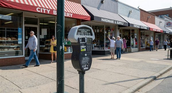
Ten years ago most cities managed the curb as a binary: metered or not, with loading and no-parking zones handled as one-off exceptions. That framework is no longer adequate. Passenger ride-hail, expanded delivery volume, micromobility, accessible loading, and street-level dining have all claimed curb space that a decade ago sat empty or held parked cars.
The response from leading cities has been to treat the curb as a designed system rather than a default allocation. The Institute of Transportation Engineers and NACTO have both published curb management frameworks reflecting this shift. The practical design decisions fall into a few recurring buckets.
The Prioritization Framework
Most contemporary curb programs start with an explicit use-priority hierarchy, varying by land-use context. A typical framework for a commercial corridor might rank uses approximately as follows:
- Safety and access (fire lanes, accessible loading, transit stops)
- Short-duration commercial loading and passenger pick-up/drop-off
- Paid short-term parking
- Longer-duration parking (metered or permitted)
- Non-parking public realm uses (parklets, dining, bike parking)
Residential contexts invert much of this ranking. Mixed-use contexts require block-by-block resolution. The value of writing the hierarchy down explicitly is that it forces the political arguments into the framework rather than into individual curb decisions later.
Loading Zone Design: The Most Underrated Tool
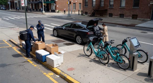
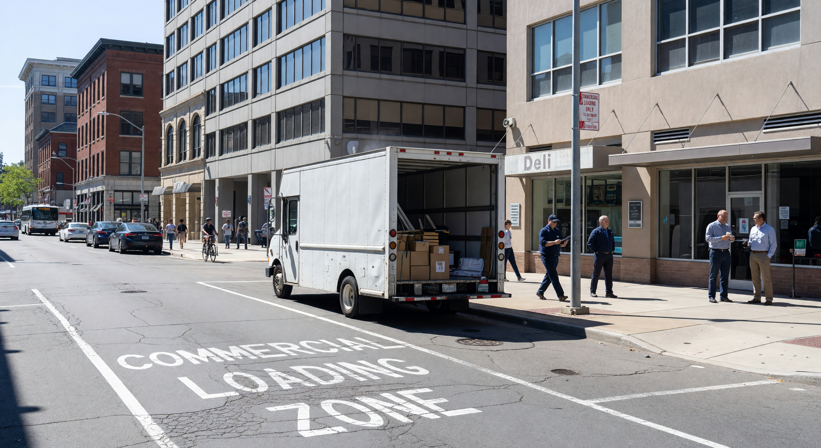
Among all curb management interventions, dedicated commercial loading zones generate disproportionate return per linear foot managed. Double-parking driven by missing or misplaced loading zones is the largest single source of urban delivery friction, and delivery vehicles cycling the block to find legal space are themselves a significant source of congestion and emissions.
Effective loading zone design attends to:
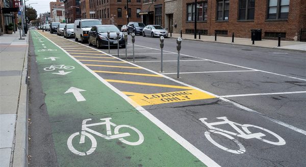
- Length. Most ordinance-standard 20- to 25-foot zones are too short for the modern single-axle delivery truck fleet. Zones of 40 to 50 feet function better in practice.
- Time-of-day variation. Loading zones that convert to metered parking or passenger zones outside delivery hours capture more value than 24-hour dedications on blocks with clear demand patterns.
- Placement relative to destinations. Zones placed near the destinations that generate the most freight deliveries — restaurant clusters, retail anchors — perform dramatically better than zones placed where space happens to be available.
- Enforcement. Loading zones without visible enforcement degrade quickly; the compliant delivery driver is displaced by the illegally parked passenger vehicle within weeks.
Several cities have rolled out sensor-based or camera-based loading zone monitoring to track occupancy and compliance. The data is now good enough to drive iterative zone placement, not just enforcement.
Dynamic Allocation: Where It Works and Where It Doesn’t
“Dynamic curb” — allocation that shifts by time of day or in response to real-time conditions — is the most-discussed frontier in curb management. The outcomes are more modest than the discourse suggests.
Time-of-day dynamic allocation (AM loading, midday metered parking, PM ride-hail, evening dining) is well-established and works reliably where signage and enforcement keep up. This is dynamic allocation in the modest sense: scheduled rather than reactive.
Real-time dynamic allocation — curb use changing in response to sensor data within a single day — has been piloted by Pittsburgh, Washington D.C., Aspen, and others. Results suggest it works best where use patterns are unusually volatile (airport curbs, event venues, freight corridors with variable truck volumes) and adds less value on standard commercial blocks where scheduled allocation captures most of the benefit.
Data Infrastructure
A credible curb management program requires, at minimum:
- An inventory of every curb linear foot, its current designation, and its regulation
- A mechanism for updating that inventory when signs or rules change
- A data standard that allows the inventory to be shared with navigation, delivery, and ride-hail platforms
The Open Mobility Foundation’s CurbLR specification and the SAE Curb Data Specification have converged on this structure. Cities without this inventory infrastructure struggle to execute more sophisticated curb interventions regardless of policy ambition.
What Most Programs Get Wrong
Two failure modes recur across programs that do not deliver expected benefits. The first is designing the program as a technology procurement rather than as a policy intervention: sensors and cameras deployed without a clear prioritization framework produce data that does not drive decisions. The second is underinvesting in enforcement capacity: curb rules that are not enforced are not rules, and the most thoughtfully designed allocation degrades within a year or two without visible enforcement presence.
FAQ
How long should a commercial loading zone be?
Most cities’ ordinance-standard 20- to 25-foot zones are too short for current delivery vehicle dimensions. Zones of 40 to 50 feet, placed near high-generation destinations, function materially better.
Is real-time dynamic curb allocation worth the investment?
For most commercial blocks, scheduled time-of-day allocation captures most of the benefit. Real-time allocation pays off in high-volatility contexts — airport curbs, event venues, active freight corridors — but is rarely the right starting point.
What data standard should a curb inventory use?
CurbLR and the SAE Curb Data Specification have largely converged. Either supports navigation, delivery, and ride-hail integrations. The specific choice matters less than having an inventory at all.
How do we prioritize curb uses when demand exceeds supply?
Most programs use an explicit use-priority hierarchy that varies by land-use context. Writing the hierarchy down before individual decisions are contested is more valuable than the specific ordering.